WHAT ARE DRONE TECHNICAL SURVEYS?
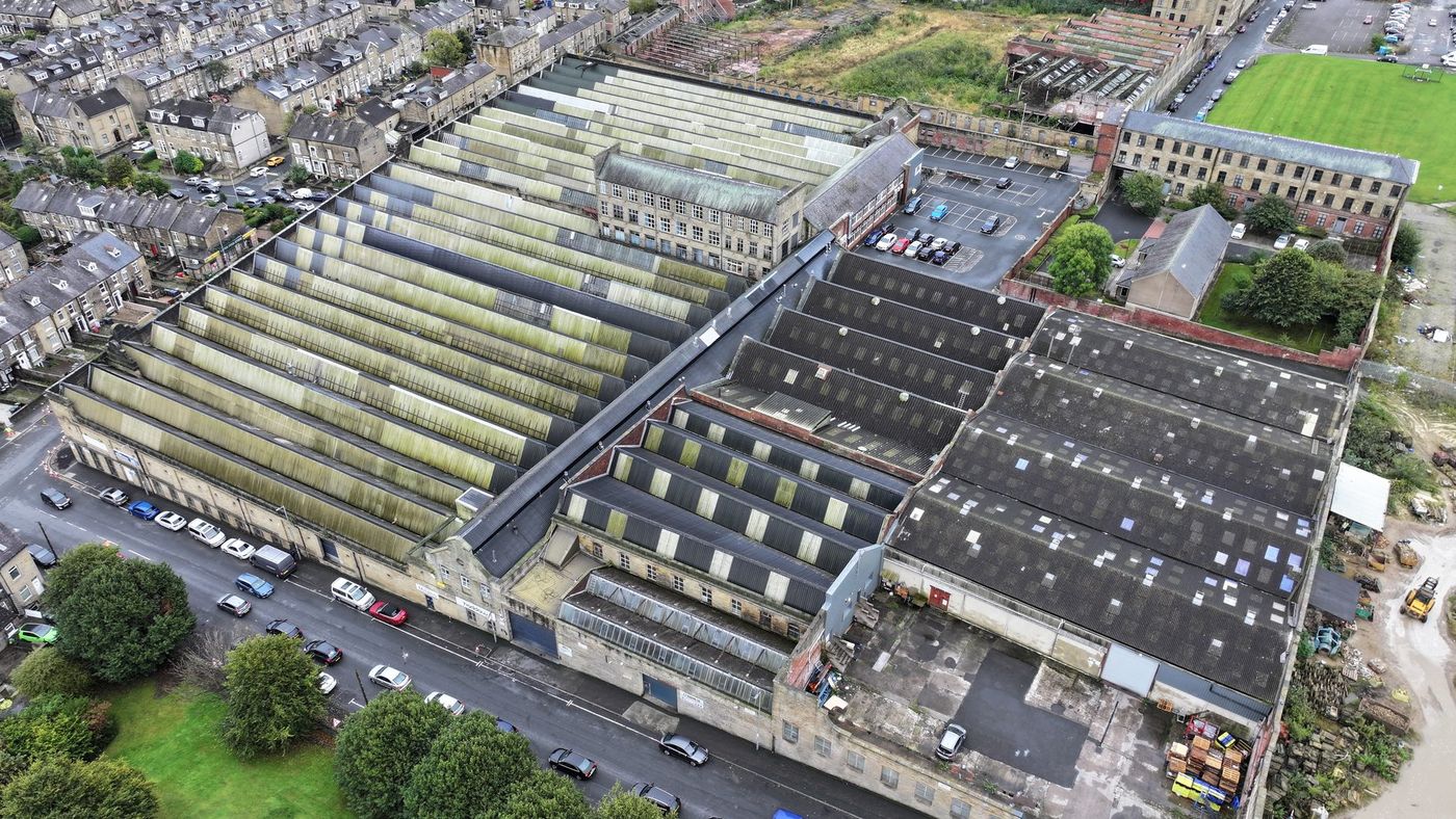
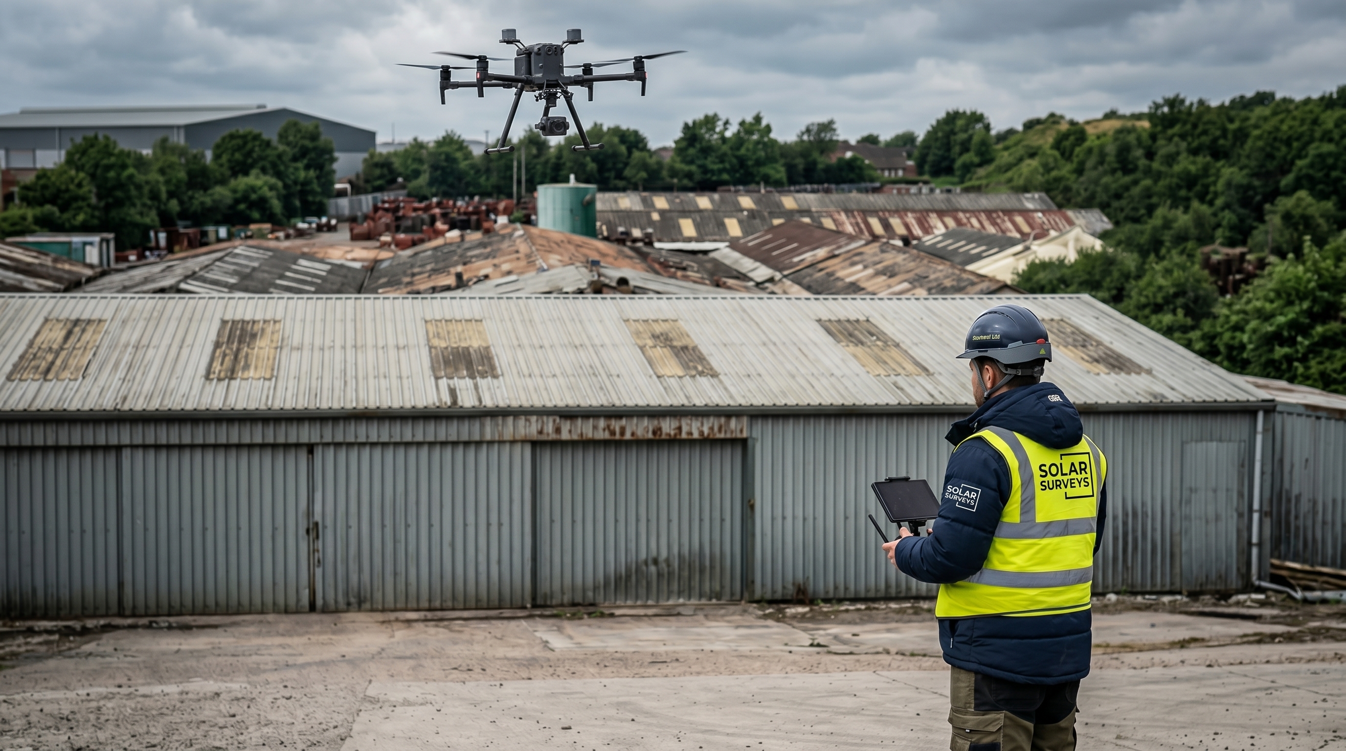
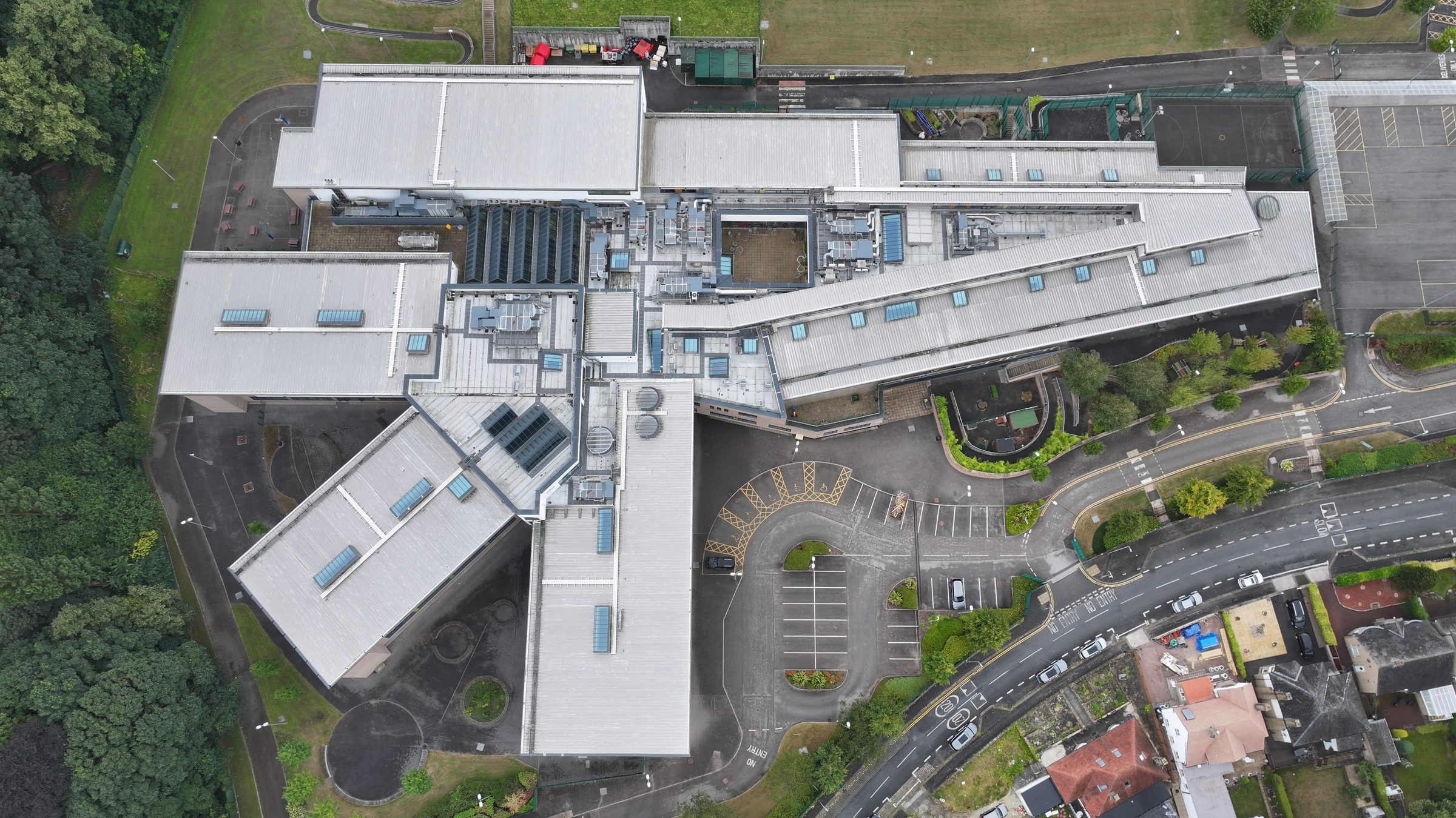
Drone technical surveys are engineer-reviewed aerial inspections of commercial and industrial structures: roofs, facades, structural steelwork, gantries and hard-to-access assets. BDF + BMFA accredited pilots capture high-resolution aerial data without scaffolding or operational disruption. A qualified structural engineer reviews all imagery and produces a written condition report with annotated findings, defect schedule and recommended actions. Solar Surveys delivers technical survey reports to the 48-hour delivery benchmark across the UK and Europe.
SERVICE A
Roof Condition Assessment
Qualitative inspection of roof covering, fixings, flashings, drainage, edge details and visible defects. Drone capture is reviewed by a qualified structural engineer. Output: a written condition report with annotated imagery and prioritised recommendations.
Use cases
- Pre-acquisition due diligence
- Annual portfolio condition tracking
- Insurance and dilapidations evidence
- Pre-PV feasibility (paired with Desktop Structural Roof Loading Report)
ASSESSMENT SCOPE
What We Inspect.
What You Receive.
Structural Steelwork
Corrosion mapping, weld assessment, bolt condition and connection degradation on exposed steelwork, portal frames and mezzanine structures, without contact or operational interruption.
Building Facades
Cladding integrity, sealant failure, panel fixings condition and weathering assessment across large commercial facades. Full elevation coverage at any height.
Canopies & Covered Structures
Car park canopies, loading bay covers, walkway canopies and external covered structures assessed for structural condition, substrate integrity and fixings status.
Rooftop Plant & Services
Condition assessment of rooftop plant, mechanical equipment, service penetrations and infrastructure, identifying deterioration risks before they affect operations or installation programmes.
Pre-Installation Surveys
Comprehensive aerial data capture for solar PV design programmes requiring broader structural intelligence beyond the roof surface, including supporting steelwork, mounting zones and structural frame condition.
Portfolio Asset Audits
Systematic drone survey programmes across large industrial or commercial property portfolios, producing a consistent, dated condition record for every asset to support maintenance planning and investment decisions.
REPORT DELIVERABLES
Aerial data without engineering interpretation is not useful. Every drone technical survey report is reviewed, annotated and structured by our Engineering Principals, giving your team precise, actionable intelligence rather than a folder of photographs.
- Annotated high-resolution aerial photography by zone
- Defect schedule with location reference, classification and severity
- Structural condition summary for each inspected element
- Recommended actions: monitor, maintain, remediate or escalate
- Pre-installation suitability classifications where applicable
- Maintenance priority schedule for asset manager use
- Engineer-signed technical output for lender or insurer submission
MATERIAL & STRUCTURE COVERAGE
THE PROCESS
Instruction to Report
in 48 Hours
Instruction & Scoping
Confirm asset location, structure type and inspection scope. We obtain flight authorisations and mobilise a BDF & BMFA accredited operator for priority deployment.
Site Capture
Systematic high-resolution aerial capture of all specified structures, assets and zones. Full coverage achieved without disruption to operations or personnel on site.
Engineer Review
Our Engineering Principals review all imagery, classify identified defects, deterioration and structural concerns, and produce annotated technical output for each inspected element.
Technical Report
Fully structured technical survey report with annotated aerial imagery, defect schedule, condition classifications and recommended actions, delivered to our 48-hour delivery benchmark.
SERVICE B
Industrial Structural Inspection
Qualitative inspection of industrial structures, gantries, stacks, silos and hard-to-access elements. Drone capture is reviewed by a qualified structural engineer. Output: a written inspection report with annotated imagery, defect register and recommendations.
Use cases
- Asset integrity reviews
- Insurance evidence
- Pre-acquisition technical due diligence
- Maintenance planning
WHO THIS IS FOR
When Access Is
a Risk or a Cost
Portfolio-Wide Condition Records
Recurring drone technical surveys across commercial and industrial portfolios give you a consistent, dated condition record for every asset, supporting planned maintenance, insurance renewals and investor-grade reporting without operational disruption.
Asset Manager Services →Pre-Commitment Asset Intelligence
Committing a long-term power purchase agreement on a commercial or industrial asset requires confidence in structural condition. Drone technical surveys deliver verified engineering-reviewed data on steelwork, facades and plant condition, across any number of sites before contracts are signed.
PPA Provider Services →Design Informed by Real Conditions
Structural steelwork condition, mounting zone suitability and rooftop access constraints all captured before your design is committed. Reduce on-site variation and abortive work by designing around verified aerial data.
EPC Firm Services →Know What You Are Installing Onto
Technical drone surveys complement structural and roof condition assessments to give you the complete picture of any commercial asset before programme commencement, identifying issues before they become your liability.
Solar Installer Services →FREE 14-PAGE BRIEF
Drone Roof Survey vs Walkover Inspection
A buyer's brief for asset managers, EPCs, and roofing programme leads choosing between a drone roof survey and a traditional walkover inspection. Deliverable comparison, lead times, insurance and risk allocation across five dimensions.
Download The BriefFREQUENTLY ASKED QUESTIONS
Drone Technical Survey Questions.
What is the difference between a drone technical survey and a drone roof condition assessment?
A drone roof condition assessment focuses specifically on the roof covering: substrate integrity, surface defects, fixings and drainage for solar PV pre-installation. A drone technical survey has a broader scope and covers industrial structures, facades, steelwork, gantries, plant and hard-to-access assets beyond the roof surface. Both services use BDF + BMFA accredited pilots and engineer-reviewed output.
What structures can be inspected using drone technical surveys?
Drone technical surveys cover structural steelwork, portal frames, building facades, cladding, rooftop plant and services, canopies, gantries, silos, stacks and any hard-to-access elements. The drone removes the need for scaffolding, MEWP hire or direct access to height, reducing both cost and safety exposure. All aerial data is reviewed by a qualified structural engineer.
Can drone technical surveys be used for insurance and dilapidations evidence?
Yes. Drone technical survey reports produced by Solar Surveys include annotated high-resolution imagery, a dated defect schedule with severity classifications and a structural condition summary signed by a qualified engineer. This format is accepted for insurance evidence, dilapidations assessments, pre-acquisition due diligence and investment-grade reporting requirements.
How quickly can Solar Surveys deliver a drone technical survey report?
Solar Surveys delivers drone technical survey reports to the 48-hour delivery benchmark from site capture. BDF + BMFA accredited pilots can mobilise within 24 hours of instruction across the UK and Europe. For portfolio programmes covering multiple assets, batch mobilisation reduces total programme lead time.
Are your drone pilots accredited and insured for commercial inspections?
Yes. All Solar Surveys drone operators hold BDF + BMFA accreditation and fly under £25M Drone Public Liability cover. Capture is reviewed and output is signed by Engineering Principals with 20+ years of structural engineering experience. Reports are accepted by lenders, insurers and technical due diligence advisors without supplementary sign-off requests.
Industrial Structural Inspection.
48-Hour Delivery Benchmark. No Scaffolding.
Commission a drone technical survey. Our BDF & BMFA accredited operators deploy rapidly across the UK and Europe. Engineer-reviewed output delivered within 48 hours.
Get a Quote