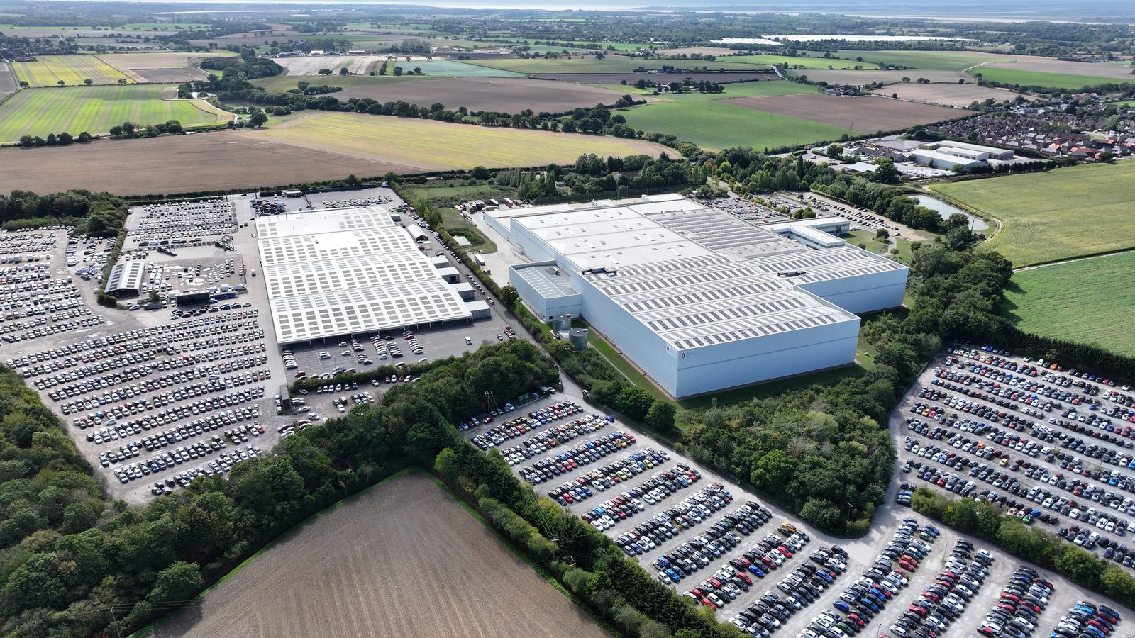
Drone technical surveys for commercial solar PV combine the aerial observation capability of unmanned aircraft systems with the analytical framework of a structured engineering inspection. The result is a comprehensive pre-installation data set that covers roof condition, structural indicators, services mapping, drainage assessment, and, where thermal imaging is specified, subsurface defect detection across the full roof surface, delivered in a fraction of the time and cost of a traditional manual inspection.
This article explains the technical components of a drone survey for commercial solar, covering the UAV systems used, the sensor payloads available, the regulatory framework governing commercial drone operations, and how the technical survey output integrates with the broader pre-installation engineering process.
UAV Systems Used in Commercial Roof Surveys
Commercial roof surveys for solar PV pre-installation use multirotor UAV platforms, typically quadrotor or hexarotor configurations. Multirotor systems are preferred over fixed-wing platforms for this application because they can hover over specific roof areas, operate at low altitude with high precision, and manoeuvre around roof-mounted obstructions. Fixed-wing systems are more suitable for large-area mapping at altitude and are not appropriate for the close-range, obstacle-rich environment of a commercial roof survey.
The choice of UAV platform affects the stability of the imagery captured, the payload capacity (which determines what sensor systems can be carried), and the operating endurance (flight time per battery set). For a standard commercial roof survey, the UAV will typically fly for 20 to 30 minutes per battery set. A 3,000 m2 flat roof requires multiple flight operations and battery changes; an experienced survey team plans the flight programme to ensure complete coverage within the available site access window.
Payload capacity determines which sensors the UAV can carry. Lighter platforms carry only visible-light cameras. Higher payload platforms can carry both a visible-light camera and a thermal imaging sensor simultaneously, enabling combined visible and thermal surveys without a repeat flight. For pre-installation surveys where both visible condition assessment and subsurface moisture detection are required, a dual-sensor platform is significantly more efficient than two separate flights with single-sensor platforms.
Visible-Light Camera Systems, Resolution and Image Quality
The visible-light camera is the primary sensor for roof condition surveys. The resolution of the camera determines the minimum size of defect that can be reliably identified from survey altitude. At a typical survey altitude of 20 to 30 metres above roof level, a 4K camera system (approximately 12 megapixels) provides ground sample distances of 5 to 10 mm per pixel, sufficient to identify membrane blistering, lap seal failures, corrosion patches, and significant drainage blockages. An 8K camera system (approximately 45 megapixels) provides ground sample distances of 2 to 5 mm per pixel, enabling detection of hairline cracking, early-stage delamination, and fine substrate deterioration that 4K systems miss at the same altitude.
Beyond sensor resolution, image quality depends on lighting conditions, camera stabilisation, and flight planning. Surveys conducted in flat, overcast light are typically better for condition assessment than surveys in bright sunshine, which creates harsh shadows that obscure details in shaded areas. A gimbal-stabilised camera mount eliminates vibration blur from the UAV motors, ensuring that imagery at the survey's maximum resolution is consistently sharp. Overlapping flight passes at 70 to 80% image overlap ensure that every area of the roof is captured from multiple angles, reducing the risk of defects being hidden beneath shadows or view obstructions in any single image.
Thermal Imaging, Applications and Limitations
Thermal imaging payloads detect variations in surface temperature, enabling identification of features that are not visible to a conventional camera. For commercial roof surveys, thermal imaging is used primarily to detect subsurface moisture: wet insulation beneath a membrane absorbs and releases heat at a different rate than dry insulation, creating thermal contrast that is visible to a thermal camera even when the roof surface above it appears intact and uniform to a visible-light camera.
Thermal surveys for moisture detection are most effective when conducted under specific conditions: the survey should be conducted at dusk or dawn when the thermal contrast between wet and dry insulation is greatest, following a period of several hours without rainfall (which would saturate the surface uniformly) and after a period of solar radiation that has differentially heated the roof surface and subsurface. These conditions are not always available on the planned survey date, and thermal survey results should be interpreted in the context of whether the survey conditions were appropriate.
The limitation of thermal imaging is that it detects thermal anomalies, not defects directly. A thermal anomaly in a roof membrane is an indicator of a potential subsurface issue that requires interpretation by an experienced surveyor. False positives from metallic objects, rooflight frames, service penetrations, and drainage outlets are common and must be distinguished from genuine moisture indicators. Experienced thermal survey operators maintain a library of reference signatures for known anomaly types that informs their interpretation of thermal imagery.
The Regulatory Framework for Commercial Drone Operations
Commercial drone operations in the UK are regulated by the Civil Aviation Authority (CAA) under the Air Navigation Order and the UK implementation of the EU UAS Regulation. Operators conducting commercial roof surveys must hold the appropriate authorisation for the operations they are conducting, which depends on the UAV class, the proximity to people and property, and the operating environment.
For most commercial roof surveys, the relevant authorisation is either an Operational Authorisation for Specific Category operations (for operations within congested or built-up areas, near aerodromes, or above the standard altitude limits) or a General Visual Line of Sight Certificate (GVC) with an appropriate Operational Authorisation. Operators conducting surveys without the appropriate authorisation are operating illegally and their survey outputs have no professional or insurance standing.
Professional drone survey firms also hold relevant industry accreditations. The British Drone Flying Association (BDF) and British Model Flying Association (BMFA) both provide frameworks for professional UAV operations. Public liability and drone liability insurance coverage is a standard requirement for commercial survey operations; insufficient insurance cover means that any damage caused during the survey operation may not be recoverable.
How Technical Survey Output Integrates with Pre-Installation Engineering
The technical survey output, structured condition report, annotated imagery, defect schedule, and drainage assessment, feeds directly into the pre-installation engineering process. The structural engineer uses the drone survey condition findings to supplement their structural assessment: indicators of purlin deflection or structural distress visible in the cladding are flagged for internal structural inspection; fixing substrate condition in specific zones informs the structural assessment's fixing adequacy conclusions; and any structural-relevant findings are cross-referenced between the two reports.
The installation design team uses the services mapping plan to finalise the array layout, the drainage assessment to design inter-row spacing and drainage provisions, and the defect schedule to identify any pre-installation remediation requirements that must be completed before the installation specification is finalised. The result is a pre-installation engineering package that gives every member of the project team, from the structural engineer to the installation manager, the information they need to deliver the installation correctly from day one.
Integrating Drone Technical Surveys into Asset Management Workflows
Commercial solar assets are increasingly managed within structured asset management programmes that schedule preventive maintenance, condition monitoring, and periodic inspections at defined intervals. Drone technical surveys are most effective when integrated into this programme structure from the outset, rather than commissioned reactively in response to performance alerts or visible damage. An asset management plan that incorporates drone technical surveys on a defined cycle, typically annual or biennial depending on asset age and environment, provides a consistent evidence base for maintenance decision-making and supports the performance reporting requirements of power purchase agreements and lender monitoring obligations. Integration with SCADA and inverter performance data allows drone survey findings to be correlated with generation anomalies, enabling maintenance teams to move directly from identified faults to targeted remediation rather than conducting additional diagnostic testing. Drone survey outputs stored in a structured asset management platform accumulate into a condition history that increases in diagnostic value over successive surveys as trends in degradation and fault development become visible.
Mobilisation Requirements and Permitted Operations Compliance
Drone operations at commercial solar sites are subject to UK CAA regulations under the UK Drone and Model Aircraft Code and, for operations beyond certain parameters, the Operational Authorisation framework. Commercial drone operators conducting technical surveys at solar sites must hold valid CAA authorisation for the intended operation, maintain appropriate public liability insurance, and comply with any site-specific operating restrictions. Before commissioning a drone technical survey, site operators should confirm: whether the site falls within a CAA flight restriction zone that requires prior notification or authorisation; whether any proximity to aviation infrastructure, military sites, or operational constraints applies; and whether the drone operator’s authorisation level covers the intended operation. Most commercial solar sites in rural or semi-rural locations are suitable for standard commercial drone operations without special authorisation, but urban rooftop sites, sites near airports, and sites within controlled airspace require additional clearance that should be confirmed before booking. Allowing adequate lead time for authorisation processes prevents programme delay on sites where restricted operations apply.
Post-Survey Deliverables and Data Format Requirements
The output of a drone technical survey is only as useful as the format in which it is delivered. Survey reports that contain image galleries without structured defect cataloguing are difficult to integrate into asset management workflows and provide limited value for maintenance planning beyond the initial review. Survey deliverables should be specified at instruction to confirm: the defect classification system used (severity ratings, defect type categories, and reference standards); image format and resolution; the method of linking defect images to their position within the array layout; and the report format compatible with the asset management platform in use. For organisations managing multi-site portfolios, standardised reporting formats that can be ingested directly into CMMS or asset management systems without manual re-entry provide the greatest operational value. Agreeing the deliverable format at instruction avoids the common scenario where technically adequate survey data is delivered in a format that requires significant manual processing before it can be used.
A drone technical survey for solar pre-construction should produce four deliverables: a georeferenced roof layout showing the proposed array footprint in relation to existing roof features; a services map identifying drainage, ventilation, and plant conflicts; a condition summary for the specific zones affected by the proposed installation; and a written engineering assessment of installation implications. Deliverables vary significantly between survey providers, confirm scope before instruction.
WHERE SOLAR SURVEYS ADDS VALUE
TECHNICAL DRONE SURVEYS, BDF & BMFA ACCREDITED, £25M LIABILITY COVER
Solar Surveys drone technical surveys are conducted by BDF and BMFA accredited operators with CAA operational authorisation and £25M drone liability insurance. 4K and 8K visible-light camera systems are used as standard; thermal imaging payloads are available for subsurface moisture detection. All surveys are conducted with gimbal-stabilised camera systems and overlapping flight pass coverage to ensure maximum image quality across the full roof surface. Reports delivered within 48 hours of the site visit.
CLIENT PROFILE
An asset manager commissioning pre-acquisition surveys for a six-site industrial portfolio specified thermal imaging as part of the drone survey scope for three sites with suspected historical moisture ingress. The thermal surveys identified subsurface moisture in a 180 m2 area of one site that was not visible in the visible-light imagery or reported in the building's maintenance records. The moisture was attributable to a repaired but not fully remediated membrane failure from a storm event two years previously. The discovery reduced the acquisition price for that site and informed the post-acquisition remediation budget. Without thermal imaging, the moisture ingress would not have been identified until post-installation investigation.
Regulatory Framework for Commercial Drone Surveys
Drone surveys for commercial rooftop assessments are conducted under the UK Civil Aviation Authority (CAA) regulatory framework, specifically the Air Navigation Order 2016 and the retained European Commission delegated regulation (EU) 2019/945 and implementing regulation (EU) 2019/947, as retained in UK domestic law after Brexit.
Key regulatory requirements relevant to commercial roof surveys:
Operator registration: Commercial drone operators in the UK must register with the CAA and hold a valid Operator ID. This is a basic minimum requirement for any commercial drone operation.
Remote Pilot qualification: For drones above 250g (virtually all survey drones), the remote pilot must hold a GVC (General Visual Line of Sight Certificate) or equivalent qualification. For survey drones operating in urban or congested environments, or in specific operational categories, additional authorisation from the CAA may be required.
Operational authorisation: Operations within Flight Restriction Zones (FRZ, typically within 5km of an aerodrome) or in certain airspace classes require specific CAA authorisation or exemptions. Commercial roof survey operators near airports must obtain the relevant permissions before operating, failure to do so is a criminal offence under UK aviation law.
When commissioning a drone survey company, clients should request confirmation of the company's CAA Operator ID, the remote pilot's GVC qualification, and confirmation of any site-specific permissions required for the survey location. Surveys conducted by operators without these qualifications are operating illegally, the survey data may be valid, but the client is potentially complicit in an unauthorised drone operation.
Data Security and Privacy Considerations
Drone surveys capture detailed photographic data of commercial properties, including information about plant, access arrangements, security systems, and neighbouring properties. This data has security implications that commercial property owners should consider before commissioning a survey.
Key data security considerations for commercial drone surveys:
- Data ownership: confirm that the survey data (including raw imagery and processed outputs) is owned by the client, not the survey company
- Data retention: agree what data retention period applies after the survey, and how data will be securely disposed of at the end of the retention period
- Data transmission: confirm that survey data is transmitted and stored securely, not on public cloud storage with shared access
- Access controls: for properties with sensitive operations (data centres, defence-related facilities, financial institutions), review what data the drone will capture about neighbouring properties and security infrastructure
UK GDPR requirements apply to any personal data captured incidentally in drone imagery, individuals identifiable on the ground, vehicle registration plates, or individuals visible through rooflights. Most commercial roof surveys take place during working hours; the survey operator should have a GDPR policy for handling incidentally-captured personal data and should share this with the client before the survey is conducted.
Post-Survey Data Management
The outputs from a drone technical survey, orthomosaics, point clouds, thermal overlays, and inspection reports, are large files (often several gigabytes) that require managed storage and distribution. For commercial solar projects, the survey data must be retained in the project file alongside the structural assessment and other technical documentation, for reference throughout the asset's operational life.
Agreed file formats for survey deliverables facilitate long-term usability:
- Orthomosaics: GeoTIFF format, georeferenced to OS National Grid (OSGB36) coordinates
- Point clouds: LAS or LAZ format, compatible with standard CAD and GIS software
- Thermal images: RJPEG or TIFF with embedded radiometric data, rather than colour-rendered JPEG which loses temperature measurement capability
- Inspection report: PDF with embedded georeferenced annotations, not just printed photographs
Data delivered in proprietary formats that require specific software to open has a limited shelf life, the software may become unavailable within the asset's 25-year operational life. Open standard formats (GeoTIFF, LAS, PDF) ensure data remains accessible throughout the asset's life without dependence on a specific software product.
THE STRUCTURAL TRINITY
Three Reports That Clear a Commercial Solar Site for Installation
READY TO COMMISSION
Get a Quote in 24 Hours.
Structural surveys, Desktop Structural Roof Loading Reports, drone assessments and solar design packages, delivered to a 48-hour benchmark.
Get a Quote